The Blue Hole of Dahab Egypt on the Red Sea is a popular diving location on east Sinai, a few kilometres north of Dahab, Egypt on the coast of the Red Sea.
"Blue Holes"are also called vertical caves[ A pit cave, or vertical cave — or often simply called a pit]. There are many different blue holes located around the world, typically in low-lying coastal regions.
 |
| The map of the hole |
What are blue holes?
Blue holes are roughly circular, steep-walled depressions, and so named for the dramatic contrast between the dark blue, deep waters of their depths and the lighter blue of the shallows around them. Their water circulation is poor, and they are commonly anoxic below a certain depth; this environment is unfavorable for most sea life, but nonetheless can support large numbers of bacteria.
The deep blue color is caused by the high transparency of water and bright white carbonate sand. Blue light is the most enduring part of the spectrum; where other parts of the spectrum—red, yellow, and finally green—are absorbed during their path through water, blue light manages to reach the white sand and return back upon reflection.
Its geography of The Blue Hole of Dahab Egypt :
Its geography of The Blue Hole of Dahab Egypt :
The Blue Hole is a kind of cave, around 130 m deep.
There is a shallow opening around 6 m deep, known as 'the saddle', opening out to the sea, and a 26 m long tunnel, known as the arch, the top of which lies at a depth of 56 m. The hole itself and the surrounding area has an abundance of coral and reef fish.
Warning
The "Arch" is reportedly extremely deceptive in several ways:
Notes:
A sinkhole: also known as a sink, snake hole, swallow hole, is a natural depression or hole in the Earth's surface, is a deep natural pit caused by karst processes — the chemical dissolution of carbonate rocks or suffusion processes for example in sandstone.
There is a shallow opening around 6 m deep, known as 'the saddle', opening out to the sea, and a 26 m long tunnel, known as the arch, the top of which lies at a depth of 56 m. The hole itself and the surrounding area has an abundance of coral and reef fish.
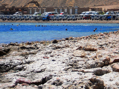 |
| The blue hole in Dahab-Egypt |
It is dangerous Dive Site. It requires suitable training and equipment.
Accidents are frequently caused when divers attempt to find the tunnel through the reef (known as "The Arch") connecting the Blue Hole and open water at about 52 m depth. This is beyond the PADI maximum advanced recreational diving limit of 40 meters and the effect of nitrogen narcosis is significant at this depth. Divers who miss the tunnel sometimes continue descending, hoping to find the tunnel farther down and become increasingly narcoses.
 |
| diving under the Arch |
- It is difficult to detect because of the odd angle between the arch, open water, and the hole itself.
- Because of the dim lighting and the fact that most light enters from outside, it appears shorter than it really is. Divers report that the Arch appears less than 10 m long but measurements have shown it is 26 m from one end to the other.
- There is frequently a current flowing inward through the arch towards the Blue Hole, increasing the time it takes to swim through.
- The arch continues downward to the seabed which is beyond view and there is therefore no "reference" from below.
- Diving through the arch requires suitable training and equipment.
However, the Arch has proved irresistible for many and thus the dive-site is considered unsuitable for beginners and a potential trap for even experienced divers.
Notes:
A sinkhole: also known as a sink, snake hole, swallow hole, is a natural depression or hole in the Earth's surface, is a deep natural pit caused by karst processes — the chemical dissolution of carbonate rocks or suffusion processes for example in sandstone.
Sinkholes may vary in size from 1 to 600 meters (3.3 to 2,000 ft) both in diameter and depth, and vary in form from soil-lined bowls to bedrock-edged chasms. Sinkholes may be formed gradually or suddenly, and are found worldwide.]
Anoxic waters: are areas of sea water or fresh water that are depleted of dissolved oxygen. This condition is generally found in areas that have restricted water exchange.
Anoxic waters: are areas of sea water or fresh water that are depleted of dissolved oxygen. This condition is generally found in areas that have restricted water exchange.
Thanks
Manal Raafat
هل قمت بزيارة الثقب الأزرق فى دهب - مصر على ساحل البحر الأحمر؟
هل قمت بالغوص هناك؟
أقدم لك هنا معلومات هامه عن الثقب الأزرق و الغوص به.
الثقب الأزرق فى مصر فى سيناء على ساحل البحر الأحمر هو موقع شعبى للغوص في شرق سيناء ، على بعد بضعة كيلومترات شمال دهب.
و عامة "الثقوب الزرقاء" وتسمى أيضا الكهوف العمودية و هى كهف على شكل حفر و في كثير من الأحيان تسمى حفرة. هناك العديد من الثقوب الزرقاء مختلفة تقع في جميع أنحاء العالم، وعادة في المناطق الساحلية المنخفضة.
 |
الثقب الأزرق في دهب، مصر
صورة حديثة من هناك |
ما هي الثقوب الزرقاء؟
هى ثقوب زرقاء دائرية تقريبا، منخفضة القاع وذات جدران حادة، وسميت بذلك لتباين اللون بين المياه العميقة ذات اللون الأزرق الداكن و المياه الضحلة التى حولها و التى تظهر لون أخف زُرقة . تيارات المياه بها تكون ضعيفة، و بها عادة نقص فى الأكسجين تحت عمق معين، وهذه البيئة غير صالحة لحياة معظم الكائنات البحريه، ولكن تكثر بها البكتيريا.
يرجع اللون الأزرق إلى الشفافية العالية للماء مع اللون الأبيض المشرق للرمال الكربونيه.
و الضوء الأزرق هو الجزء الأكثر دواما و بقاءً من ألوان الطيف؛ حيث أن الألوان الأخرى من الطيف الأحمر، الأصفر، الأخضر يتم امتصاصها خلال مسارها من خلال المياه، والضوء الأزرق يتمكن من الوصول إلى الرمال البيضاء والإنعكاس الينا لنرى اللون أزرق صافى رائع.
جغرافيا الثقب الأزرق فى دهب:
هو نوع من الكهوف و يبلغ عمقه 130 متر.
و يوجد به فتحة ضحلة عمقها حوالى م 6، و معروفة باسم السرج و هى فتحه الخروج إلى البحر، ونفق طويل 26 متر، والمعروفة باسم القوس،و تقع قمته على عمق 56 متر.
أما الحفرة نفسها والمنطقة المحيطة بها لديها وفرة من الشعاب المرجانية و الأسماك.
تحذير
موقع خطرللغوص. فإنه يتطلب التدريب العالى و المعدات المناسبة.
في كثير من الأحيان يكون سبب الحوادث للغواصين هو محاولة العثور على النفق من خلال الشعاب (المعروف باسم "قوس") الذي يربط بين الثقب الأزرق والمياه المفتوحة في عمق متر 52. (هذا هو أبعد من الحد الأقصى العالمى للغوص الترفيهى و الذى يبلغ 40 مترا).
و السبب الآخر هو التأثير المخدر للنيتروجين الذى يتزايد بتزايد العمق. فالغواصين الذين يقفدون الطريق إلى النفق يستمروا فى النزول أحيانا على أمل العثور على النفق مما يصيبهم بالتخدير بسبب زيادة النيتروجين .
|
الغوص تحت القوس
|
و"القوس" خادعة للغاية فى عدة جوانب :
- فمن الصعب إكتشافه بسبب الزاوية الغريبة بين القوس والمياه المفتوحة، والثقب نفسه.
- بسبب الإضاءة الخافتة، وحقيقة أن معظم الضوء يدخل من الخارج، و يبدو أقصر مما هو عليه حقا( حقيقة علمية). فمثلا سجل الغواصين تقريرا يفيد بأن القوس يظهرعلى بعد أقل من 10 مترا لكن القياسات أظهرت أنه على بعد 26 م .
- كثيرا ما يكون هناك تيارات تمر من خلال القوس إلى الداخل نحو الثقب الأزرق، مما يعمل على زيادة الوقت المستغرق في السباحة.
- القوس يكمل مساره نزولا إلى قاع البحر.
و لهذا فإن الغوص من خلال القوس يتطلب تدريبا ومعدات مناسبة.
و على هذا فإن الغواصين الذين يقاومون إغراء قوس ويعرفون مدى تدريبهم والقيود الآزم إتباعها فى الغوص يكونوا فى أمان.
ومع ذلك، فقد ثبت أن قوس لا يقاوَم بالنسبة للكثيرين، وبالتالي فهو يعتبر غير مناسب و خطير على المبتدئين .
شكرا
منال رأفت
No comments:
Post a Comment