Sunday, March 13, 2011

Petra Of Jordan البترا الاردنيه

Petra is considered the most famous and gorgeous site in Jordan located about 262 km south of Amman and 133 km north of Aqaba. It is the legacy of the Nabataeans, an industrious Arab people who settled in southern Jordan more than 2000 years ago. 
It is a vast, unique city, carved into the sheer rock face by the Nabataeans, an industrious Arab people who settled here more than 2000 years ago, turning it into an important junction for the silk, spice and other trade routes that linked China, India and southern Arabia with Egypt, Syria, Greece and Rome.


Petra meaning rock is a historical city in the Jordanian governorate of Ma'an that is known for its rock cut architecture and water conduits system. Established sometime around the 6th century BC as the capital city of the Nabataeans, it is a symbol of Jordan as well as its most visited tourism attraction. It lies on the slope of Mount Hor in a basin among the mountains which form the eastern flank of Arabah (Wadi Araba), the large valley running from the Dead Sea to the Gulf of Aqaba.Petra has been a UNESCO World Heritage Site since 1985. UNESCO has described it as "one of the most precious cultural properties of man's cultural heritage.Petra is known as the Rose-Red City for the color of the rocks in which Petra is carved .

Petra sights are at their best in early morning and late afternoon, when the sun warms the multicolored stones, you can view the majesty of Petra as it was seen first when discovered in 1812 after being lost by the 16th century for almost 300 years! 


Its History 
Evidence suggests that settlements had begun in and around Petra in the eighteenth dynasty of Egypt (1550-1292 BC). It is listed in Egyptian campaign accounts and the Amarna letters .

You can find there Roman-style theatre, which could seat 3,000 people. There are obelisks, temples, sacrificial altars and colonnaded streets, and high above, overlooking the valley, is the impressive Ad-Deir Monastery – a flight of 800 rock cut steps takes you there.

Within the site there are also two excellent museums; the Petra Archaeological Museum, and the Petra Nabataean Museum both of which represent finds from excavations in the Petra region and an insight into Petra's colourful past.


البتراء او المدينه الورديه 
 البتراء وكذلك تسمى سلع، مدينة تاريخية تقع في الأردن جنوب البلاد 225 كم جنوب العاصمة عمّان إلى الغرب من الطريق الرئيسي الذي يصل بين العاصمة عمّان ومدينة العقبة 
تعتبر البتراء من أهم المواقع الأثرية في الأردن وفي العالم لعدم وجود مثيل لها في العالم مؤخرا فازت بالمركز الثاني في المسابقة العالمية لعجائب الدنيا السبع وهي عبارة عن مدينة كاملة منحوته في الصخر الوردي اللون ومن هنا جاء اسم بترا وتعني باللغه اليونانية الصخر
 بناها الأنباط في العام 400 قبل الميلاد وجعلوا منها عاصمة لهم  وعلى مقربة من المدينة يوجد جبل هارون الذي يعتقد أنه يضم قبر النبي هارون عليه السلام والينابيع السبعة التي ضرب موسى بعصاه الصخر فتفجرت. واختيرت البتراء بتاريخ7/7/2007 كواحدة من عجائب الدنيا السبع الجديدة

   تاريخ البتراء

كانت البتراء عاصمة لدولة الأنباط وأهم مدن مملكتهم التي دامت ما بين 400 ق م وحتى 106 م، وقد امتدت حدودها من ساحل عسقلان في فلسطين غربا وحتى صحراء بلاد الشام شرقا.و من شمال دمشق وحتى البحر الاحمر جنوبا, شكل موقع البتراء المتوسط بين حضارات بلاد ما بين النهرين وبلاد الشام والجزيرة العربية ومصر أهمية أقتصادية فقد أمسكت دولة الأنباط بزمام التجارة بين حضارات هذه المناطق وسكانها وكانت القوافل التجارية تصل إليها محملة بالتوابل والبهارات من جنوب الجزيرة العربية والحرير من غزة ودمشق والحناء من عسقلان والزجاجيات من صور وصيدا واللؤلؤ من الخليج العربي.
نهاية دولة الأنباط كان على يد الرومان عندما حاصروها ومنعوا عنها مصادر المياه سنة 105 وأسموها الولاية العربية. وفي سنة 636 أصبحت البتراء تعيش على من تبقى من سكانها على الزراعة لكن الزلزال الذي أصابها سنة 746/748 وزلازل أخرى أفرغتها من أهله


THANKS

Friday, March 11, 2011

Solar eclipse. How to make with Photoshop كسوف الشمس و كيفية تنفيذه بالفوتوشوب

As seen from the Earth [ Earth (or the Earth) is the third planet from the Sun and the densest and fifth-largest of the eight planets in the Solar System.], a solar eclipse occurs when the Moon passes between the Sun and the Earth, and the Moon [The Moon is Earth's only natural satellite and the fifth largest satellite in the Solar System.]fully or partially covers the Sun as viewed from a location on Earth. This can only happen during a new moon, when the Sun and Moon are in conjunction as seen from Earth. At least two, and up to five, solar eclipses occur each year.

The original picture 

The photo shop picture


The last total solar eclipse was the solar eclipse of July 11, 2010; the next will be the solar eclipse of November 13, 2012.

A total solar eclipse is a natural phenomenon. Nevertheless, in ancient times, and in some cultures today, solar eclipses have been attributed to supernatural causes or regarded as bad omens [ An omen is a phenomenon that is believed to foretell the future]. A total solar eclipse can be frightening to people who are unaware of their astronomical explanation, as the Sun seems to disappear during the day and the sky darkens in a matter of minutes. 


Types of Solar eclipse 
There are four types of solar eclipses:
  1. A total eclipse ,occurs when the dark shadow of the Moon completely obscures the  bright disk of the Sun,allowing the much fainter solar corona to be visible. [ A corona is a type of plasma "atmosphere" of the Sun , extending millions of kilometers into space .The Greek root of the word corona means crown.]
  2. An annular eclipse occurs when the Sun and Moon are exactly in line, but the apparent size of the Moon is smaller than that of the Sun. Hence the Sun appears as a very bright ring, or annulus, surrounding the outline of the Moon. 
  3. A hybrid eclipse (also called annular/total eclipse) shifts between a total and annular eclipse. At some points on the surface of the Earth it appears as a total eclipse, whereas at others it appears as annular. Hybrid eclipses are comparatively rare. 
  4. A partial eclipse occurs when the Sun and Moon are not exactly in line and the Moon only partially obscures the Sun.
Viewing the Sun during partial and annular eclipses requires special eye protection, or indirect viewing methods, to block the harmful part of the Sun's radiation to protect the eyes from being damaged.

Sunglasses do not make viewing the sun safe. Only properly designed and certified solar filters should be used for direct viewing of the Sun's disk.

The safest way to view the Sun's disk is by indirect projection. This can be done by projecting an image of the disk onto a white piece of paper or card using a pair of binoculars (with one of the lenses covered), a telescope, or another piece of cardboard with a small hole in it (about 1 mm diameter), often called a pinhole camera. 
كسوف الشمس 
ظاهرة فلكية تحدث عندما تتوضع الأرض والقمر والشمس على استقامة واحدة تقريبا ويكون القمر في المنتصف أي في وقت ولادة القمر الجديد فى  مطلع الشهر القمري بحيث يلقى القمر ظله على الأرض

أنواع الكسوف 
كسوف كلي 
كسوف جزئي
كسوف حلقي أو خاتميّ  
كسوف  خليط من نوعي نما بين الكسوف الكلي والكسوف الحلقي 


هذا الفيديو باللغه العربيه عن كسوف الشمس 


HOW TO MAKE THAT DESIGN ?

Tuesday, March 08, 2011

Thutmose III تحتمس الثالث

Thutmose III that means Thoth is born .He was the sixth Pharaoh of the Eighteenth Dynasty.

He was co-regent with his stepmother, Hatshepsut
He became the pharaoh of the kingdom after her death [ Hatshepsut was the fifth pharaoh of the eighteenth dynasty of Ancient Egypt ,and was named the pharaoh. ] He created the largest empire Egypt had ever seen,he conquered from Niya in north Syria to the fourth waterfall of the Nile in Nubia. Thutmose III ruled Egypt for almost fifty-four years, this includes the twenty-two years he was co-regent to Hatshepsut his stepmother and aunt. During the final two years of his reign, he appointed his son-and successor-Amenhotep II, as his junior co-regent. When Thutmose III died, he was buried in the Valley of the Kings as were the rest of the kings from this period in Egypt.

 His Family
Thutmose III was the son of Thutmose II by a secondary wife, Iset [ Iset or Isis she was named after goddess Isis].His father's great royal wife was Queen Hatshepsut. Her daughter Neferure was Thutmose's half-sister. 
When Thutmose II died Thutmose III was too young to rule, so Hatshepsut became his regent, soon his coregent, and shortly thereafter, she declared herself to be the pharaoh while never denying kinship to young Thutmose III.

His wives 
  • Satiah: She may have been the mother of his firstborn son, Amenemhat.
  • Merytre-Hatshepsut. His successor, the crown prince and future king Amenhotep II, was the son of Merytre-Hatshepsut.
  • Nebtu: she is depicted on a pillar in Thutmose III's tomb.
  • Menwi, Merti, Menhet three foreign wives.
Thutmose III was a great builder pharaoh and constructed over fifty temples,some of these are now lost and only mentioned in written records.

Death and burial  
He died after ruling Egypt for 53 years, 10 months, and 26 days .He was buried in the Valley of the Kings.

Mummy  
Thutmose III's mummy was discovered in the Deir el-Bahri Cache above the Mortuary Temple of Hatshepsut in 1881.The height of Thutmose III's mummy to be 1.615m (5 ft. 3.58in.),and the feet were absent .

تحتمس الثالث
 الفرعون الأسطورة.. سادس فراعنة الأسرة الثامنة عشر، ويعتبر أعظم حكام مصر وأحد أقوى الاباطرة في التاريخ 

اسماء الفرعون
اسم الولادة :  دى جو تى مس
اسم التتويج :من خبر رع
اسم الحورس :  الثور القوي 
ملك الوجهين بحري وقبلي : يدوم الملك 
 الاسم الذهبي  : ذو الهيئة المقدسه

براعه تحتمس العسكرية 
كان تحتمس الثالث يتمتع بسمات شخصية خارقة وعبقرية عسكرية ليس لها مثيل تدرب تحتمس في ساحات المعارك في الاقصر.. وقد اكسبته هذه التدريبات صلابة في شخصيته وخبرات عسكرية عظيمة، وتظهر لنا تماثيل تحتمس الثالث هذا الشاب المفتول العضلات وقد امتلك ميزات جعلته ملكا محاربا أسطوريا قام بستة عشرة حملة عسكرية على آسيا (منطقة سورية وفلسطين) استطاع ان يثبت نفوذه هناك كما ثبت نفوذ مصر حتى بلاد النوبة جنوبا، وقد كان امير مدينة قادش في سوريا يتزعم حلفا من امراء البلاد الأسيوية في الشام ضد مصر وصل عددهم إلى ثلاثة وعشرين جيشا وكان من المتوقع أن يدعم تحتمس الثالث دفاعاته وقواته على الحدود المصرية قرب سيناء إلا أن تحتمس قرر الذهاب بجيوشه الضخمة لمواجهة هذه الجيوش في اراضيهم ضمن خطة توسيع الامبراطورية المصرية إلى أقصى حدود ممكنة وهزيمة هذه الجيوش مجتمعة.
درب تحتمس الجنود على أفضل التدريبات وقسم جيشه إلى قلب وجناحين واستخدم تكتيكات عسكرية ومناورات لم تكن معروفة من قبل وبنى القلاع والحصون


براعته السياسية 
استدعى تحتمس الثالث أبناء أمراء الأقاليم الأسيوية إلى طيبة عاصمة مصر في ذلك الوقت، ليتعلموا في مدارسها العادات والتقاليد المصرية ويثقفهم بالثقافة المصرية، ويغرس في نفوسهم حب مصر، حتى إذا عادوا إلى بلادهم وتولوا الحكم فيها أصبحوا من اتباعه المخلصين وبالتأكيد لا يمكن التفكير في الحرب على مصر، ويشكك بعض المؤرخين ان هذا هو فرعون خروج  بنى اسرائيل من مصر 

اعماله المعمارية 
بنى تحتمس الثالث في طيبة العديد من المعابد منها معبدين أحدهما بجانب معبد حتشبسوت في الدير البحري، كما قام ببناء البوابتان العملاقة السادسة والسابعة وقاعة الاحتفالات في معبد الكرنك وأكمل بناء معبد حابو الذي بدأته حتشبسوت وله العديد من الانشاءات فى اماكن اخرى منها ايضا ما لا يقل عن سبع مسلات معظمها موجود الآن في عدد من عواصم العالم منها المسلة الموجودة في لندن  

الفرعون الامبراطور 
أقام تحتمس الثالث أقدم امبراطورية في التاريخ وهي أقصى حدود لمصر في تاريخها حيث وصلت حدود مصر إلى نهر الفرات و سوريا شرقا وإلى ليبيا غربا وإلى سواحل فينيقيا وقبرص شمالاو إلى منابع النيل جنوبا حتى الجندل الرابع أو الشلال الرابع وكانت الإدارة في عهده قوية من ذوى الكفاءات العالية حيث اعطى تحتمس كل إقليم حكما ذاتيا تابعا للعرش نظرا لاتساع الامبراطورية واختلاف الاجناس وتباين الاعراف والقوانين من منطقة لأخرى 
  
موته و مقبرته 
مات تحتمس وعمره 82 سنة بعد أن حكم أربعة وخمسين عاما .ولم يعرف تاريخ مصر ملكا بكى عليه المصريون وحزنوا عليه حزنا شديدا مثل ما حدث مع تحتمس الثالث، وبعد وفاته أقيمت مراسم الحداد والدفن الملكية تبعه فيها كل المصريين وهي أضخم جنازة في التاريخ القديم ودفن في مقبرة بوادي الملوك كان قد أعدها لنفسه 

من أشهر مقولاته لوزيره الشهير رخمى رع "لا يرضى الرب بالتحيز(الفساد)، كن يقظا فمنصب الوزير عماد الأرض كلها فليس للوزير أن يستعبد الناس، استمع للشاكى من الجنوب والدلتا أو أى بقعة.. تصرف بالعدل فالمحاباة يمقتها الرب.. كن عادلا مع من تعرفه ومن لا تعرفه 

That is a very short summery of the life story of that grate king .
I had designed that background and add the photo of the king to it .That background was designed with photo shop using filters only and some other sinple tools .

Some uses of filters and how to use for designing the background.  


Sunday, March 06, 2011

Cairo - Egypt القاهره المصريه

Cairo, and the area around it are considered to be the heart of Egypt.

Cairo is the Egyptian capital.The meaning of the name is" The Vanquisher" or "The Conqueror".
It is the capital of Egypt, the largest city in Africa and the 16th most populous metropolitan area in the world[ The first city is Tokyo of Japan ]. 


Cairo is also ranked as one of the most densely populated cities in the world. Nicknamed "The City of a Thousand Minarets"[ Minarets are distinctive architectural features of Islamic mosques- generally tall spires with onion-shaped or conical crowns, usually either free standing or taller than any associated support structure; the basic form includes a base, shaft, and gallery. Styles vary regionally and by period. They provide a visual focal point and are used for the call to prayer ] for its preponderance of Islamic architecture, Cairo has long been a centre of the region's political and cultural life.  
The city's original name in Arabic is "Al-Qahira", which became "Cairo" after Europeans corrupted the name. Egyptians today often refer to Cairo as Maṣr, the Arabic pronunciation of the name for Egypt itself.

Cairo has the oldest and largest film and music industries in the Arab World, as well as the world's second-oldest institution of higher learning, al-Azhar University[ is an educational institute in Cairo, Egypt. Founded in 970~972 as a madrasa, it is the chief centre of Arabic literature and Sunni Islamic learning in the world. It is the oldest degree-granting university in Egypt after Cairo University. In 1961 non-religious subjects were added to its curriculum.]. Many international media, businesses, and organizations have regional headquarters in the city, and the Arab League has had its headquarters in Cairo for most of its existence.Cairo is by far the largest city in Egypt.

Its Geography and location
Cairo is located in northern Egypt, known as Lower Egypt, 165 kilometers (100 mi) south of the Mediterranean Sea and 120 kilometers (75 mi) west of the Gulf of Suez and Suez Canal.The city is along the Nile River, immediately south of the point where the river leaves its desert-bound valley and branches into the low-lying Nile Delta region. Although the Cairo metropolis extends away from the Nile in all directions, the city of Cairo resides only on the east bank of the river and two islands within it on a total area of 453 square kilometers .


Famous places in Cairo

  • Tahrir Square: The middle picture in the collection  
  • The Egyptian Museum
  • Khan El-Khalili
  • Old Cairo
  • Cairo Tower :The Cairo Tower is a free-standing concrete TV tower in Cairo. It stands in the Zamalek district on Gezira Island in the Nile River, in the city centre. At 187 meters, it is 43 meters higher than the Great Pyramid of Giza, which stands some 15 km to the southwest. The upper right picture in the collection. 
  • Gates to the Ancient City of Cairo: Cairo was called the citadel or tabia or forte, i.e. stronghold. It looked like a square; 1200m2 in length and 1100m2 in width. It was surrounded with El Bahr El Azeim (the great sea) from the east, the gulf from the west, from the north gardens extended to Mataria and the mount Gabal El Guishi from the south.


    When the Fatimid reign (969-1171) settled in Cairo under the leadership of El Moez Li-Dinellah it was called "Cairo of El Moez" because they decorated its four suburbs with luxurious buildings, delightful spots and gardens. This increased its delightfulness and beauty. It was the settlement of rulers and princes.


    El Fostat city was big and important due to plenty of buildings, many people and much of livelihood means, that is why Gawhar El Sakaly was so keen on it. He established the fortified gates (bab) and installed them around it in the four-sided wall. He built El Kantara at Bab El Shairia Street. He also built a wall to quickly surround the Palace. But this was destroyed completely.

    Purposes of the gates
Those gates did not only defend the country against enemies, but were built also for management and administrative purposes. No one was allowed to enter Cairo or stay there except for its residents, or those who go in for certain reasonsand in daytime only. 
There are many gates like , Bab El Barkia 1st gate ,Bab El Barkia 2nd gate ,El Bab El Gadid, Bab Zuweila,Bab El Wazir,Bab El Nasr, and many other gates[ Bab mean gate in Arabic ]

If I will write every thing about Cairo Egypt It will be very long post you might get tired of reading.
I had collected some pictures in a collection in the upper left side the picture of the Nile River ,the lower left side is Salah El Deen Citadel .The middle picture for Tahrir Square ,the upper right picture for Cairo Tower .The last picture is the lower right picture ,which is the picture of Baron Empain Palace who was the designer of one of the most important places of Cairo.

 القاهرة الساحره قاهرة المعز هي عاصمة جمهورية مصر العربية وأهم مدنها علي الإطلاق، يبلغ عدد سكان مدينة القاهرة حوالى   9,000,000 مليون نسمه تقريبا يمثلون حوالى 10 % من إجمالي سكان مصر، في حين يبلغ عدد سكان القاهرة الكبرى 20 مليونًا ونصف مليون نسمة. يسكنها أكثر من ربع سكان مصر البالغ تعدادهم بالداخل والخارج مايقرب من 88 مليون نسمه
تشمل القاهره الكبرى القاهرة، الجيزة، محافظة 6 أكتوبر ومدينة حلوان. و أجزاء من محافظة القليوبية في مصر و هي امتداد عمراني طبيعي للقاهرة

سميت تاريخيا باسم مدينة الألف مئذنة لكثرة مساجدها 

أسّسها من عدة مدن ولتكون عاصمة، القائد المعز لدين الله لفتح القاهرة بعد أن أسس الدولة الفاطمية، وقد قام جوهر الصقلي سنة 358 هـ (969 م) ببناء سور حول ثلاث مدن وقام بتسمية المدن الثلاث القاهرة، وتضمّ القاهرة مدينة الفسطاط التي أسسها عمرو بن العاص سنة 20هـ، ومدينة العسكر التي أسسها صالح بن علي العباسى سنة 132هـ، ومدينة القطائع التي أسّسها أحمد بن طولون سنة 256هـ، بالإضافة إلى الأحياء التي طرأت عليها بعد عهد صلاح الدين وحتى الآن.

القاهرة هي أكبر مدينة أفريقية والأكثر سكاناً في أفريقيا والشرق الأوسط. وهي محافظة مدينة، أي أنها محافظة تشغل كامل مساحتها مدينة واحدة 
هناك العديد من الاماكن الجميله و الاثريه التى يمكن لك ان تزورها فى القاهره متل المتحف المصرى وبعض المتاحف الاخرى مثل المتحف الزراعى و متحف الفن الاسلامى و القبطى و السكه الحديد ومتاحف اخرى ويمكنك ايضا زياره القاهره القديمه و ابوابها مثل باب زويله و باب النصر وباب الفتوح و العديد من الابواب التى انشئت لحمايه المقيمين فى المدينه حيث انه لا يمكن لاحد غير قاطنيها الدخول من هذه الابواب 
يمكنك ايضا زياره خان الخليلى وبرج القاهره  

 
The new thing in that post is the 3D text in the middle of the picture.

There is another simple 3D text in Arts Of Photos .

HOW TO DO THE 3D TEXT?

Friday, February 25, 2011

Hurghada الغردقه - مصر

Hurghada is a city in the Red Sea Governorate of Egypt. It is a main tourist center and second largest city (after Suez) in Egypt located on the Red Sea coast.Hurghada stretches for about 36 kilometres (22 mi) along the seashore, and it does not reach far into the surrounding desert. 


Hurghada was founded in the early 20th century, and until a few years ago, remained a small fishing village. But today, it has gone on to become the foremost tourist resort of the Red Sea coast and an international center for aquatic sports. If it takes place in or on the water you can do it here, like windsurfing, sailing, deep-sea fishing, swimming, but, above all, snorkeling and diving. The unique underwater gardens offshore are some of the finest in the world, justifiably famous amongst divers. The warm waters here are ideal for many varieties of rare fish and coral reefs, which may also be observed through glass bottom boats. 

Its Climate 
Hurghada has a Subtropical-Desert climate, with mild-warm winters and hot to very hot summers. 

About Hurghada
- located on the West Cost of the Red Sea around 40 km cost line.

- population: 55.000 including around 7.000 foreigners.


- There are around 200 hotels in Hurghada.

- there are 70.000 tourists from Europe coming every week to Hurghada.

- sun is shining 99% days in the year

- hotest months: July, August, coldest months:
 January, February.


Holiday in Hurghada 
Hurghada is an exciting and vibrant holiday destination suitable for all ages and can be found on the western side of Egypt's Red Sea Riviera. 
Hurghada is known as a party town, particularly among Europeans.Locals and others will tell you that life begins at night in Hurghada, with the many, many clubs.  
Hurghada is perfect for those seeking total relaxation with fantastic weather and warm sea temperatures throughout the year.

Things to Do in Hurghada 
There is plenty to do in Hurghada ranging from day trips to watersports. 
--Hughada Diving is also popular as many people look forward to exploring the underwater marine life. 
--In the meantime, take advantage of the relaxing atmosphere and stunning scenery and spend time exploring Hurghada and the area around this fascinating city.
--Excursions are always available for visitors. With day trips to other parts of Egypt.
--Enjoy sea and sand .
--Hurghada Diving:Enjoy fantastic underwater marine life.
-- Hurghada Watersports: Choose from sailing, fishing and windsurfing, and more like banana rides, pedal boats and canoeing.
--Hurghada Shopping 
--Hurghada Nightlife :Beside hotels, duty free shops and some restaurants ,and discos,and cafe shops .

الغردقة مدينة مصرية على ساحل البحر الأحمر وعاصمة محافظة البحر الأحمر. فيها ميناء تجاري ويقصدها السياح لشواطئها والأنشطة البحريةالعديده بها 

تاريخها 
 اكتسبت الغردقة اسمها من شجرة الغردق، كما هي عادة تسمية الأماكن (و خصوصا الصحراوية) بأسماء النباتات المنتشرة فيها أو الأشجار الميزة 
نشأت الغردقة في أوائل القرن العشريــن كعباره عن وديان صحراويه ، يسكنها بدو مصرييـن يعملون في الصيد والبداوة من عرب الرشنديه وجهينه القادمين من الجزيره العربيه والعبابده على ساحل البحر الاحمر وبـدأ نموهـا باكتشــاف النفط في تلك المنطقة سنة 1913 إلا أن طفرة حدثت في أوائل ثمانينيات ثمانينيات القرن عندما بدأت تُعرف كمنطقة جاذبة لهواة الغطس، وتسارع نموها في العقدين التاليين لتصبح أحد أهم المدن السياحية في مصر. وكانت مدينة الغردقة تنقسم إلى ثلاثة أحياء رئيسية: حي السقالة (الميناء) جنوب المحافظة وهو الذي كان يضم أغلب السكان العاملين بالصيد ؛ وحي الدهار وهو الذي كان يضم مبنى المحافظة والجهات الحكومية الأخرى والسوق التجاري ؛ وحي الأحياء شمالا وهي منطقة منعزلة يقطنها السكان الذين كان يعمل معظمهم في المعهد القومي لعلوم البحار والمصايد الذي تم إنشاؤه في 1930 أو مركز الشباب المجاور للمعهد

 شهرة الغردقه 
تشتهر الغردقه  بصيد أسماك القرش البراكودا* أبوشراع – أبوسيف * بياض – قاروق – مرجان 
  اكتسبت الغردقه شهره كبيره فى مجال السياحه و خاصه سياحة الشواطئ والمنتجعات وقد اكتسبت الغردقة هذه السمعة الكبيرة في سنوات قليلة، ويرجع ذلك الى القيمة السياحية والجمالية للغردقة والتي ليس لها مثيل وكذلك و توفر التسهيلات السياحية والرياضية بسرعة كبيرة وبمستويات رائعة في هذه المنطقة
من اهم الانشطه التى تمارس فى الغردقه الرياضات البحرية من تزلج وإبحار وغوص فمياهها الدافئة تحتضن أنواعا نادرة من الاسماك والشعاب المرجانية 

       اشهر المعالم السياحيه
 أثار رومانية بجبل الدخان على بعد 65 كم شمالاً
متحف الأحياء المائية على بعد 4 كم من شمال ميناء الغردقة
الشعاب المرجانية
المعهد القومي لعلوم البحار والمصايد

اهم المزارات
 وادي الحمامات
دير الأنبا أنطيونيوس
دير الأنبا بولا
ضريح أبو الحسن الشاذلي

  I designed that card as an invitation card to visit my lovely and favorite place .You can fold it in the middle.

HOW TO DESIGN THAT CARD ?

 Please visit Arts Of Photos  

Monday, February 21, 2011

Sharm el-Sheikh شرم الشيخ

Sharm el-Sheikh is one of the most popular tourist places in the Arab world. But there are also some very good reasons to visit it if you are not the common tourist, who likes to lie on the beach all day. It is one of the finest diving spots in the world and a trip into the desert is an unforgettable adventure. 


Sharm el-Sheikh is a city situated on the southern tip of the Sinai Peninsula, in South Sinai Governorate, Egypt, on the coastal strip along the Red Sea. Its population is approximately 35,000 (2008). It is popular with package holiday makers and divers.

Its Name 
Sharm el-Sheikh is sometimes called the "City of Peace", referring to the large number of international peace conferences that have been held there.It is also transliterated as Sharm ash- Shaykh and popularly known simply as "Sharm".It means bay of the Sheikh.

 Its History and Geography 
Sharm el-Sheikh is on a promontory overlooking the Straits of Tiran at the mouth of the Gulf of Aqaba
About 40 years ago, Sharm el-Sheikh was nothing but a small fishing village with about 100 Bedouin citizens,but its strategic importance led to its transformation from a fishing village into a major port .
Sharm el-Sheikh city has been subdivided into five homogeneous centers, namely Nabq, Ras Nusrani, Naama Bay, Umm Sid and Sharm El Maya[ Na'ama Bay part of the city is the center of nightlife and dining: most of Sharm's clubs, cafes, restaurants and shops are here].There is also an airport in Sharm el-Sheikh. Sharm el-Sheikh Airport is the largest in the Sinai, and receives plane-loads of charter tourists daily in the winter high season. The only airline for local flights is Egypt Air .
The land plan shows that the total area of Sharm el-Sheikh is expected to be about 42 square kilometres by the year 2017.


 During the 2011 Egyptian protests, President Hosni Mubarak reportedly went to Sharm el-Sheikh and resigned there on 11 February 2011.

Climate 
The average temperatures during the winter months (November to March) range from 15 to 35 degrees Celsius (59-95°F) and during the summer months (April to October) from 20 to 45 degrees Celsius (68-113°F). The temperature of the Red Sea in this region ranges from 21 to 28 degrees Celsius (70-84°F) over the course of the year. 

Tourism  in Sharm
Sharm el-Sheikh's major industry is foreign and domestic tourism, owing to its dramatic landscape, year-round dry and temperate climate and long stretches of natural beaches. Its waters are clear and calm for most of the year and have become popular for various watersports, particularly recreational scuba diving and snorkeling which some consider to be among the best in the world.There is great scope for scientific tourism with diversity in marine life species; 250 different coral reefs and 1000 species of fish.

Diving
Diving is the main activity in Sharm el-Sheikh. When you dive into the warm water of the Red Sea and leave the remote desert behind, you will enter a world full of life and colors.

 شرم الشيخ هي أكبر مدن محافظة جنوب سيناء هي مركز سياحي عالمي. تشتهر بالغوص. بالجنوب منها توجد محمية راس محمد الطبيعية 
وصف شرم الشيخ
توجد بها وحولها أهم المحميات الطبيعية في رأس محمد ونبق. وأمام شرم الشيخ توجد جزيرتا تيران وصنافير عند مدخل خليج العقبة.. ومن أهم مناطقها رأس نصرانى ورأس أم سيد إلى جانب رأس محمد 
فازت شرم الشيخ بجائزة اليونيسكو ضمن افضل خمس مدن سلام فى العالم من بين 400 مديته عالميه

مميزاتها 
    تعتبر شرم الشيخ من أحدث مناطق الاستجمام والاسترخاء في العالم، وفي خلال عشر سنوات أصبح فيها أكثر من 150 فندقا  
يستطيع السائح ايضا اختيار مايلائمه من النشاطات المتعدده هناك ركوب الخيل أو لعب التنس، أو ملاهي الأطفال، إلى التزلج على الماء، أو الغطس أو الغوص حيث أصبحت سياحة مراكز الغوص تمثل اليوم نشاطا سياحيا يلقى رواجا كبيرا وبأعداد غير عادية تعكسه زيادة عدد هذه المراكز.

 أرض السلام
 مدينة شرم الشيخ يشار إليها دائماً بأنها "أرض السلام" أو " مدينة السلام " وذلك لأن أرضها تشهد عقد مؤتمرات وقمم حول السلام والعديد من المؤتمرات السياسية والعلمية والسياحية 


After all of what I had mentioned about Sharm I decided to design an invitation card with its name .That you can fold like a book in the middle .
That card is designed with illustrator .

HER HOW TO DESIGN WITH ILLUSTRATOR . 

Friday, February 18, 2011

Red Sea البحر الاحمر

The Red Sea is a seawater inlet of the Indian Ocean, lying between Africa and Asia.The connection to the ocean is in the south through the Bab el Mandeb strait and the Gulf of Aden. In the north, there is the Sinai Peninsula, the Gulf of Aqaba, and the Gulf of Suez leading to the Suez Canal .
Illustrator design for the red sea

The Name
Red Sea is a direct translation of the Greek Erythra Thalassa . Arabic Al-Baḥr Al-Aḥmar or Baḥr Al-Qalzam.The name of the sea may signify the seasonal blooms of the red-coloured Trichodesmium erythraeum[ is a type of filamentous cyanobacteria] near the water's surface.
Another hypothesis is that the name comes from the Himyarite, a local group whose own name means red.
It is theorized that it was named so because it borders the Egyptian Desert, which the ancient Egyptians called the Dashret or "red land"; therefore it would have been the sea of the red land.The mountains surrounding the red sea [ Red Sea Mountains]is high and reddish in color.
The Red Sea is one of four seas named in English with color terms [ the Black Sea, the White Sea and the Yellow Sea].


Its History
The earliest known exploration of the Red Sea was conducted by Ancient Egyptians, as they attempted to establish commercial routes to Punt [type of boats]. One such expedition took place around 2500 BC, and another around 1500 BC. Both involved long voyages down the Red Sea.
Along the history there were many attempts to connect The Red Sea with The White Sea ,that ends with The Suez Canal ,that was opened in November 1869.


The Tourism
The sea is known for its spectacular sport diving sites, such as Ras Mohammed ,and Rocky Island in Egypt and less known sites in Sudan such as Sanganeb, Abington, Angarosh and Shaab Rumi .Popular tourist resorts include El Gouna, Hurghada, Safaga, Marsa Alam, on the western shore of the Red Sea, and Sharm-El-Sheikh, Dahab, and Taba on the Egyptian side of Sinaï, as well as Aqaba in Jordan and Eilat in Israel in an area known as the Red Sea Riviera.
Tourism in the South of the Red Sea is presently considered risky because of the presence of pirates originating from uncontrolled zones of Somalia. Large vessels such as cargoes are sometimes attacked by heavily armed high-speed boats. The situation is even worse in the Gulf of Aden between Somalia and Yemen.


Under the red sea you can see different colors and shapes of fish. I had never dive under the red sea but I had tried to imagine what is there and I designed that picture .

 I designed it with Illustrator ,using the Symbol Panel ,Free Transform to adjust the size[ scale] direction . 


فى اعماق البحر الاحمر تعيش الكائنات البحريه المختلفة الالوان والاحجام والاشكال

لم اتمكن يوما من الذهاب هناك ولم اتمكن من ممارسة رياضه الغطس ابدا ولكننى حاولت تخيل ماذا يمكن ان اراه هناك

حاولت تدوين ورسم ما تخيلته بطريقه مبسطه ارجو ان تنال اعجابكم .

نبذة عن البحر الحمر
البحر الأحمر هو مدخل مياه البحر من المحيط الهندي، الواقع بين أفريقيا وآسيا. يتصل بالمحيطالهندي من الجنوب من خلال باب المندب وخليج عدن. 
وفي الشمال يتفرع إلى خليج العقبة، وخليج السويس و المؤدى إلى قناة السويس و تقع شبه جزيرة سيناء بين الخليجين .

ويسمية العرب بـ (بحر القُلْزُم) بضم القاف وسكون اللام وضم الزاي

سبب تسميته
*** البحر الأحمر هي ترجمة مباشرة للكلمة اليونانية إريثرا ثالاسا
*** وهناك فرضيات أخرى هي 
--- أن الاسم قد أتي من قبيلة حمير التي كانت تقطن فى اليمن.
--- وأيضا أيد بعض العلماء العصريين نظرية أن الأحمر هو اسم يشير إلى اتجاه الجنوب، كما البحر الاسود قد يشير إلى الشمال. وعلى أساس هذه النظرية بعض اللغات الآسيوية تستخدم أسماء الألوان للإشارة إلى الاتجاهات السماوية . وقد كان هيرودوت في المناسبة الواحدة يستخدم كلمة البحر الأحمر وبحر الجنوب بشكل متبادل.
---  ونظرية أخرى للتسمية لأن حدود البحر الأحمر على الصحراء المصرية ، والتي كان القدماء المصريين يسمونها Dashret أو "الأرض الحمراء"


البحر الأحمر أحد الأربعة بحار المسماة بأسماء الألوان والأخرى هى البحر الأسود، البحر الأبيض والبحر الاصفر(يقع فى كوريا الشماليه و الجنوبية).


الموارد الحية

** يوجد أكثر من 1200 نوع من الأسماك التي سجلت في البحر الأحمر، و حوالي 10 ٪ منها لاتوجد في الأماكن الأخرى. وهذا يشمل أيضا 42 نوعا من أسماك المياه العميقة. 
** يوجد به 2000 كيلومتر (1240 ميل) من الشعاب المرجانية على امتداد الساحل، وعمر هذه الشعاب المتاخمة يتراوح ما بين 5000-7000 سنة .


و من أهم مدن البحر الأحمر الغردقة و سفاجا و شرم الشيخ و دهب و طابا و رأس محمد و السويس و العين السخنه و غيرهم

ارجو ان اكون قد وفقت فى هذة النبذة عن البحر الأحمر 

شكرا لكم 

Tuesday, February 15, 2011

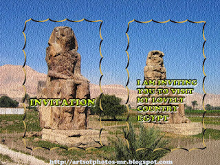
Colossi of Memnon of Pharaoh Amenhotep III.العملاق ممنون امنحتب الثالث

 The Colossi of Memnon are two massive stone statues of Pharaoh Amenhotep III. For the past 3400 years (since 1350 BC) they have stood in the Theban necropolis [ Thebes is the Greek name for a city in Ancient Egypt located about 800 km south of the Mediterranean, on the east bank of the river Nile. The Valley of the Kings is located also in Thebes.], across the River Nile from the modern city of Luxor.

The original picture   

The twin statues show Amenhotep III  in a seated position, his hands resting on his knees and he is looking eastwards towards the river. Two shorter figures are carved into the front throne alongside his legs: these are his wife Tiy and mother Mutemwiya. The side panels depict the Nile god Hapy.
 The statues are made from blocks of quartzite sandstone which was stone quarried at el-Gabal el-Ahmar (is located today within the boundaries of modern-day Cairo, in the area of Nasr City . The name means "The Red Hill".) and transported 675 km (420 miles) overland to Thebes. (They are too heavy to have been transported upstream on the Nile.) 
The blocks used by later Roman engineers to reconstruct the eastern colossus may have come from Edfu (north of Aswan). Including the stone platforms on which they stand (about 4 metres (13 ft) themselves), the colossi reach a towering 18 metres (approx. 60 ft) in height and weigh an estimated 700 tons each. The two figures are about 15 metres (50 ft) apart. 
Both statues are quite damaged, with the features above the waist virtually unrecognizable. The western (or southern) statue is a single piece of stone, but the eastern (or northern) figure has a large extentive crack in the lower half and above the waist consists of 5 tiers of stone. These upper levels consist of a different type of sandstone, and are the result of a later (Roman Empire) reconstruction attempt. It is believed that originally the two statues were identical to each other, although inscriptions and minor art may have varied.

The original function of the Colossi was to stand guard at the entrance to Amenhotep's memorial temple[ The Mortuary Temple of Amenhotep III (known in modern times as Kom el-Hettan, ) is located in the Theban necropolis, on the west bank of the Nile, opposite Luxor in Egypt. It was built for the Pharaoh Amenhotep III. When constructed it was the largest of the mortuary temples in the Theban area, larger than the complex at Karnak, and covered an area of 350,000 square metres.] 
Amassive cult centre built during the pharaoh's lifetime, where he was worshipped as a god-on-earth both before and after his departure from this world. In its day, this temple complex was the largest and most rich in Egypt.  
With the exception of the Colossi, very little remains today of Amenhotep's temple.


The Name
Memnon was a hero of the Trojan War[ Greek mythology],The name Memnon means "Ruler of the Dawn", and was probably applied to the colossi because of the reported cry at dawn of one of the statues .Eventually, the entire Theban Necropolis became generally referred to as the Memnonium.  


Sounds
In 27 BC, a large earthquake had destroyed the eastern colossus,collapsing it from the waist up and cracking the lower half. Following its rupture, the remaining lower half of this statue was then reputed to "sing" on various occasions- always within an hour or two of sunrise, usually right at dawn. The sound was most often reported in February or March . The description varied;some said it sounded "like a blow",others  compared it to "the string of a lyre[ The lyre is a stringed musical instrument]" breaking,it also was described as the striking of brass[ Brass is an alloy of copper and zinc; the proportions of zinc and copper can be varied to create a range of brasses with varying properties] or whistling.

ضخامة ممنون او ممنون العملاق وهما من التماثيل الحجرية الضخمة للفرعون أمنحتب الثالث
   وصف التمثال 
  التمثالين التوأم تصور أمنحتب الثالث في وضع الجلوس ، تستريح  يديه على ركبتيه وبصره متوجه شرقا باتجاه النهرعلى الجانب لوحات تصور اله النيل حابى اما من الجهه الاماميه للعرش حفرشكلين لكل من الملكه تى و الام
التماثيل مصنوعة من كتل من الحجر الرملي الكوارتزالتى جلبت من الجبل الاحمر بالقرب من القاهره 

 الاسم
 ممنون كان بطل حرب طروادة ، ملك إثيوبيا الذي قاد جيوشه من أفريقيا إلى آسيا الصغرى للمساعدة في الدفاع عن المدينة المحاصرة ولكن في نهاية المطاف قتل أخيل و يعنى اسم ممنون ايضا حاكم الفجر نظرا للاصوات التى تصدر منه وقت الفجر وخاصه فى شهرى فبراير و مارس وقدمت تفسيرات مختلفة لهذه الظاهرة ، وهذه هي من نوعين : طبيعية أو من صنع الإنسان.


For that Colossi statue,and great king Amenhotep III ,I wanted to make some thing different .I found myself fixing the photo and designing many things .I will show and explain ,hoping that you will like it .


 The first design.I found it nice as invitation card .I designed it with both illustrator and photo shop.


 The second design.I draw a frame with the Brush Tool ,manually. 
  
The third design ,with dissolve frame.

The fourth ,with black marbled glossy frame .

HOW TO DESIGN IT ?

Sunday, February 13, 2011

Pharaoh of Ancient Egypt الفرعون المصرى القديم

Pharaoh is a title used in many modern discussions of the ancient Egyptian rulers of all periods.The title means ‘’great house’’ and describes the royal palace.The title of Pharaoh started being used for the king during the New Kingdom, specifically during the middle of the eighteenth dynasty. For simplification, there is a general acceptance amongst modern writers to use the term to relate to all periods.

The original picture                                                                                             The picture after fixing 


Here I had a picture of a Pharaoh  wearing the Nemes[ The nemes was the striped headcloth worn by pharaohs in ancient Egypt. It covered the whole crown and back of the head and nape of the neck (sometimes also extending a little way down the back) and had two large flaps which hung down behind the ears and in front of both shoulders] headdress, a false beard, and an ornate kilt holding the ANKH [ key of life, the key of the Nile].
يطلق لقب فرعون فى العصور الحديثه على حاكم او ملك مصر القديمه كما اطلق لقب كسرى على ملك فارس وقيصر على ملك الروم
 وكان الحاكم في مصر القديمة الموحدة يلبس تاج القطرين (تاج احمر رمز الشمال وتاج أبيض رمز الجنوب متحدين في تاج واحد دلالة على حكم القطرين وتسلطه عليهما)، أي أنه يحكم مصر العليا ومصر السفلى 
يعتقد علماء المصريات الغربيين أن لقب "فرعون" في اللغة المصرية القديمة تعني "المنزل الكبير" أو "البيت الكبير " أو ما يعني "الباب العالي "حيث انه لم يعثر على اى دليل فى اى خرطوش من الخراطيش ية التي تحمل أسماء الملوك يشير إلى ذلك اللقب
I wanted to add a background to the picture to change it.

How to add the background ? 
Please visit Arts Of Photos  

Saturday, February 12, 2011

Egypt مصر

 Egypt is more than 7,000 years old . Across the centuries there have been numerous cultures and peoples who have lived in Egypt and ruled it too. The name now is  Arab Republic of Egypt .
 Some important and lovely faces from Egypt ,old and new .I had grouped it in one picture .


Its geography and Location
is a country mainly in North Africa, with the Sinai Peninsula forming a land bridge in Southwest Asia. Egypt is thus a transcontinental country, and a major power in Africa, the Mediterranean region, the Middle East and the Islamic world. Covering an area of about 1,010,000 square kilometers (390,000 sq mi), Egypt is bordered by the Mediterranean Sea to the north, the Gaza Strip and Israel to the northeast, the Red Sea to the east, Sudan to the south and Libya to the west. 
Egypt is one of the most populous countries in Africa and the Middle East. The great majority of its estimated 85 million people live near the banks of the Nile River, in an area of about 40,000 square kilometers (15,000 sq mi), where the only arable land is found. The large areas of the Sahara Desert are sparsely inhabited. About half of Egypt's residents live in urban areas, with most spread across the densely populated centers of greater Cairo, Alexandria and other major cities in the Nile Delta.

Egypt is famous for its ancient civilization, with famous monuments such as the Giza pyramid complex and its Great Sphinx. Its ancient ruins (remaining s), such as those of Memphis, Thebes, and Karnak and the Valley of the Kings outside Luxor. 

Its Economy 
The economy of Egypt is one of the most developed and diversified in the Middle East, with sectors such as tourism, agriculture, industry and service at almost equal production levels. 

The development of its Name  
The ancient Egyptian name of the country is Kemet which means "black land", referring to the fertile black soils of the Nile flood plains, 
The English name Egypt was borrowed from Middle French Egypte, from Latin Aegyptus, from ancient Greek Aígyptos .

Egypt has many periods in its history.
  • Pre-historic Egypt.
  • Ancient Egypt.
  • Ptolemaic and Roman Egypt.
  • Arab and Ottoman Egypt.
  • Muhammad Ali dynasty.
  • Modern Egypt. 
 Its Climate 
Most of Egypt's rain falls in the winter months. Snow falls on Sinai's mountains and some of the north coastal cities such as Damietta, Baltim, Sidi Barrany, etc. and rarely in Alexandria.
Temperatures average between 80 °F (27 °C) and 90 °F (32 °C) in summer, and up to 109 °F (43 °C) on the Red Sea coast. Winter temperatures average between 55 °F (13 °C) and 70 °F (21 °C). 

 Religion
Egypt hosts two major religious institutions.
  •  Islam , as its state religion. Around 90% are identified as Muslim.
  •  Christianity ,There is a significant minority of Christians in Egypt, who make up between 5% and 10% of the population[  the Coptic Orthodox Church of Alexandria ].


مصر أو رسميا جمهورية مصر العربية،
هي دولة تقع في أقصى الشمال الشرقي من قارة أفريقيا، يحدها من الشمال الساحل الجنوبي الشرقي للبحر المتوسط ومن الشرق الساحل الشمالي الغربي للبحر الأحمر ومساحتها 1,002,450 كيلومتر مربع[2]. مصر دولة تقع معظم أراضيها في أفريقيا غير أن جزءا من أراضيها، وهي شبه جزيرة سيناء، يقع في قارة آسيا، فهي دولة عابرة للقارات. تشترك مصر بحدود من الغرب مع ليبيا، ومن الجنوب مع السودان، ومن الشمال الشرقي مع (إسرائيل) فلسطين  وقطاع غزة، وتطل على البحر الأحمر من الجهة الشرقية. تمر عبر أرضها قناة السويس التي تفصل الجزء الآسيوي منها عن الجزء الأفريقي.
ويتركز أغلب سكان مصر في وادي النيل، وبالذات في القاهرة الكبرى التي بها تقريبا ربع السكان، والإسكندرية؛ كما يعيش أغلب السكان الباقين في الدلتا وعلى ساحلي البحر المتوسط والبحر الأحمر ومدن قناة السويس ،وتشغل هذه الأماكن ما مساحته 40 ألف كيلومتر مربع. بينما تشكل الصحراء غالبية مساحة الجمهورية وهي غير معمورة. معظم السكان في مصر حاليا من الحضر، ربعهم في القاهرة الكبرى
تشتهر مصر بالحضارة الفرعونية وبعض المعالم الأكثر شهرة في العالم، مثل أهرام الجيزة وأبو الهول وآثارها القديمة مثل الموجودة في مدينة منف وطيبة والكرنك ووادي الملوك، وأهتمام كبير من الدراسات الأثرية، ويتم عرض أجزاء من هذه الاثار من هذه المواقع في المتاحف الكبرى في جميع أنحاء العالم. مصر تمتلك واحدة من أكثر الاقتصادات نموا وتنوعا في الشرق الأوسط، مع قطاعات مثل السياحة والزراعة والصناعة والخدمات وتأتى مستويات الإنتاج على قدم المساواة تقريبا. إن الاقتصاد المصري ينمو نموا سريعا، ويرجع ذلك إلى تشريعات تهدف إلى جذب الاستثمارات ،مع إضافة كل من الاستقرار الداخلي والسياسي، جنبا إلى جنب مع التجارة الحديثة وتحرير السوق

أصل الاسم
اسم مصر في اللغة العربية واللغات السامية الأخرى مشتق من جذر سامي قديم قد يعني البلد أو البسيطة (الممتدة)، وقد يعني أيضا الحصينة أو المكنونة.وقد عرفها العرب باسم "مصر". أما الاسم الذي عرف به الفراعنة موطنهم في اللغة هو كِمِت وتعني "الأرض السوداء"، كناية عن أرض وادي النيل السوداء تمييزا لها عن الأرض الحمراء الصحراوية المحيطة بها
 Aegyptus مشتق من الاسم الاتينى  Egypt 

الديانات
توجد في مصر مؤسستان دينيتان من أقدم وأهم المؤسسات بالنسبة للدين التي تمثله كل منهما
الأزهر، الذي بناه الفاطميون لنشر المذهب الإسماعيلي في شمال أفريقيا، قبل أن يحوله صلاح الدين الأيوبي إلى جامعة سنية 
 ليصير أحد أهم أعمدة الإسلام السني في العالم. وشيخ الأزهر حاليا الشيخ الدكتور أحمد الطيب الرئيس السابق لجامعة الأزهر

ودار الإفتاء المصرية[دار الإفتاء التي تأسست عام 1895م[27] والتي يترأسها مفتي الديار المصرية، ويتولّى هذا المنصب حاليًا الشيخ علي جمعة.

الكنيسة القبطية الأرثوذكسية، وهي إحدى أقدم الكنائس المسيحية في العالم وواحدة من الكنائس الخمس الأول، وكنيسة الإسكندرية هي مقر الجالس على كرسي مار مرقس وهو بابا الإسكندرية وبطريارك الكرازة المرقسية، والبابا الحالي هو الأنبا شنودة الثالث

وبناء على هذا فان الديانه الرسميه للبلاد هى الاسلام ويدين به نحو 90% من السكان
الدياته الثانيه هى المسيحيه الارسوذكسيه   
 العاصمه و اكير المدن :القاهره
تعداد السكان :85 مليون
العمله الرسميه الجنيه المصرى 

Valentine's Day يوم الحب

It is an annual commemoration held on February 14 celebrating love,and affection between intimate companions,and friends.

احبك
Love You

Valentines Day is a day to express your love, and to celebrate the spirit of love.lovers express their love for each other by presenting flowers,gifts,sweets and also sending greeting cards .The day first became associated with romantic love.
Modern Valentine's Day symbols that have been used over a long period of time, include:
  •  The heart-shaped outline,because it was believed that the heart was the seat of all human emotions .
  • Roses ,and its red color .The color red is associated with strong emotions .
  • Ribbons,scarf or handkerchief.
  • Traditional symbols like Cupid,and birds.
 I designed that card to send for everybody in that occasion .
That card is designed with both illustrator and photo shop.
I got the flowers from illustrator and open it in photo shop ,then with the layer style and Type tool option I wrote the word  .

I wish for you all happy valentine's day and happy life . Please accept my card as a gift for you in that occasion,
you can find more in Arts Of Photos 


يوم الحب هو مناسبه سنوية عالميه هو يوم 14 فبراير فى هذا اليوم تقدم الهدايا و الورود كتعبير عن المحبه الصادقه 
بدا هذا اليوم للمتحابين ثم اصبح لكل الناس للاصدقاء والاقارب المقربين 
تستطيع تقديم ورود او ورود او هديه رقيقه تعبيرا عن المحبه الصادقه والمشاعر الرقيقه
وبصفة عامه الهديه ليست بقيمتها وانما بما ترمز اليه
ارجو ان تتقبلوا هذا الكرت هديه منى اليكم تعبيرا عن حبي للجميع 

THANKS
Manal Raafat

Monday, February 07, 2011

Tahrir Square- Cairo- Egypt ميدان التحرير قلب القاهرة و شاهد على حضارة مصر و تاريخها العريق - القاهرة - مصر

Some characteristic items in the square and its branches.
صور لبعض الأماكن الموجوده بميدان التحرير 


Tahrir Square is the main Square in the heart of Cairo the capital of Egypt.

Today I want to give you an idea about Tahrir Square [ Midan Al-Tahrir , Liberation Square] 
It is a major public town square in Downtown Cairo, Egypt.The heart of Cairo. The houses there are combination of old and modern styles In addition it is the public transport center almost for all Cairo places and extensions ,so the square is one of the most important and busiest areas in the city.


Its History  
No body can forget the rule of Khedive Ismael and his dream to create a ‘Paris on the Nile’ .He chose some of the best engineers in Egypt at that time like Ali Mubarak that had been graduated in France to help him to achieve his dream.The engineers designed the square to have wide,wide roads,and public gardens and royal palaces. He started his series of palaces or ‘Kasr’ such as Kasr al-Aini, Kasr al-Nil among many others.By that time its name was Midan al-Ismaileyya[ Ismaileyya square], and likewise the district was called al-Kahira al-Ismaileyya afterthe Khedive.
One of the first constructions on the site was Al-Nil Palace which housed the army of the khedive and was later theheadquarters of the British Army of Occupation in the late 1880s.
It was renamed Midan al-Tahrir or Liberation Square in 1954 .


Its Features 
At the centre of Tahrir Square is a large and busy traffic circle. On the north-east side is a plaza with a statue of  Omar Makram [ in the picture], and beyond it the Omar Makram Mosque.The area around Tahrir Square includes the Egyptian Museum, the Mogamma government building, the Headquarters of the Arab League building, the Nile Hotel, and the original downtown campus of the American University in Cairo.

ميدان التحرير 
الواقع بقلب العاصمة المصريه القاهرة.
يتميز الميدان بالصبغة التاريخية للمكان فالعمارات تحمل عبق التاريخ و الشورارع المتفرعه منه و كذلك التماثيل الموجوده هناك انشئت فى فترة القاهرة الخديويه.
و نجد بالصورة السباع (الأسود) التى اتى بها الخديوى إسماعيل ووضعها على مداخل كوبرى قصر النيل ز من هنا جاء إسم ابو السباع الذى يطلق حاليا على كل من يحمل إسم إسماعيل.
و يوجد بمحيط ميدان التحرير ايضا المتحف المصرى و الذى يعتبر من اعظم متاحف العالم, و يحتوى على المقتنيات الأثريه الرائعة.
و يوجد أيضا مبنى الجامعة الأمريكية و التى أنشئت من قبل كمبنى لأول جامعة مصريه و أنشأها قاسم أمين مع رفاقه. و عندما زاد عدد طلاب الجامعة نقلت الى المبنى الحالى فى الجيزة.
و هناك ايضا العديد من الفنادق العالمية الكبيرة مثل الهيلتون و الشيراتون و الفور سيزونز.
و يوجد ايضا جامع عمر مكرم و هو من اهم جوامع مصر. و أماكن اخرى عديدة مثل مجمع التحرير .

ميدان التحرير قلب القاهرة و شاهد على حضارة مصر و تاريخها العريق على مر العصور    

شكرا لكم
منال رأفت
  

The Quote Of The Day.

You lie the loudest when you lie to yourself.

One thing you can give and still keep...is your word.

Subscribe to get all our new posts free via email

Enter your email address:

Delivered by FeedBurner

Like